Tocht Stappen Le Haut-Soultzbach - Sentheim - Lac de la Seigneurie (20/01/2022) - Photo

Sentheim - Lac de la Seigneurie (20/01/2022)

 Richard68500
Richard68500

Gebruiker

© OpenStreetMap contributors
Lengte
Lengte
13,3 km
Max. hoogte
Max. hoogte
428 m
Positief hoogteverschil
159 m
Km-Effort
Km-Effort  
15,4 km
Min. hoogte
Min. hoogte
356 m
Negatief hoogteverschil
157 m
Boucle
Boucle
Ja
Datum van aanmaak :
2022-01-20 08:35:52.415
Laatste wijziging :
2022-01-20 16:39:28.971

(0 Bericht)

Stappen
Stappen
3h17
Moeilijkheid : Gemakkelijk

Scan deze QR-code om de tocht te openen in de SityTrail-applicatie

Gratisgps-wandelapplicatie

Logo SityTrail SityTrail

IGN / Geografische instituten

SityTrail uit de App Store downloaden SityTrail uit Google Play downloaden

Logo SityTrail SityTrail World

De wereld gaat voor u open

SityTrail uit de App Store downloaden SityTrail uit Google Play downloaden SityTrail op Huawei AppGallery downloaden

Over ons

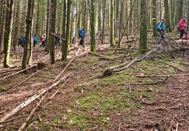
Tocht Stappen van 13,3 km beschikbaar op Grand Est, Haut-Rhin, Le Haut-Soultzbach. Deze tocht wordt voorgesteld door Richard68500.

Beschrijving

Randonnée facile avec peu de dénivelé

Hoogteprofiel

Plaatsbepaling

Land:
France
Regio :
Grand Est
Departement/Provincie :
Haut-Rhin
Gemeente :
Le Haut-Soultzbach
Locatie:
Mortzwiller
Vertrek:(UTM)
351916 ; 5289857 (32T) N.

Wandeltochten in de omgeving

Tocht Stappen Masevaux-Niederbruck - Masevaux - Rossberg par le belvédère du Fuchsfelsen - Photo
Stappen
Bart2015

Stappen

Medium
(1)
Masevaux-Niederbruck, Grand Est, Haut-Rhin, France
19,9 km | 34 km-effort
4h 44min
Ja
Tocht Stappen Sentheim - Sentheim Rossberg - Photo
Stappen
helmut68

Stappen

Medium
(1)
Sentheim, Grand Est, Haut-Rhin, France
27 km | 40 km-effort
6h 11min
Ja
Tocht Stappen Lauw - 2022-07-14 Marche Lauw Refuge CAF Baerenkopf - Photo
Stappen
GUIDE
holtzv

Stappen

Zeer moeilijk
Lauw, Grand Est, Haut-Rhin, France
18,4 km | 31 km-effort
5h 35min
Neen
Tocht Te voet Sentheim - Sentier géologique du Wolfloch - Photo
Te voet
PRO

Te voet

Gemakkelijk
Sentheim, Grand Est, Haut-Rhin, France
3,8 km | 4,8 km-effort
1h 5min
Neen
Tocht Te voet Sentheim - Sentheim - Bergwald - Eichwald - Guevenheim - Sentheim - Photo
Te voet
patrickbeyrath

Te voet

Gemakkelijk
(1)
Sentheim, Grand Est, Haut-Rhin, France
13,4 km | 16,6 km-effort
Onbekend
Ja
Tocht Stappen Sentheim - Randonnée Pentecôte 2024 - Photo
Stappen
helmut68

Stappen

Medium
Sentheim, Grand Est, Haut-Rhin, France
14,8 km | 18,3 km-effort
4h 0min
Ja
Tocht Stappen Masevaux-Niederbruck - Rando CLAS du 25/04/2024 - Photo
Stappen
boubou68

Stappen

Zeer moeilijk
Masevaux-Niederbruck, Grand Est, Haut-Rhin, France
17 km | 28 km-effort
4h 24min
Ja
Tocht Stappen Sentheim - Knapphutte Saegenkopf Hütte - Photo
Stappen
helmut68

Stappen

Medium
Sentheim, Grand Est, Haut-Rhin, France
13,8 km | 17,2 km-effort
5h 11min
Ja
Tocht Stappen Sentheim - Montori - Photo
Stappen
helmut68

Stappen

Medium
Sentheim, Grand Est, Haut-Rhin, France
17,7 km | 24 km-effort
4h 47min
Ja


Sluiten
Mijn abonnementen